We both slept well after not arriving to our overnight sight until almost 10:00 last night. We (almost) NEVER arrive that late. We (almost) NEVER even arrive after dark. But last night was special. Today we are still glad we did it. Don’t recommend arriving after dark, but sometimes it happens.
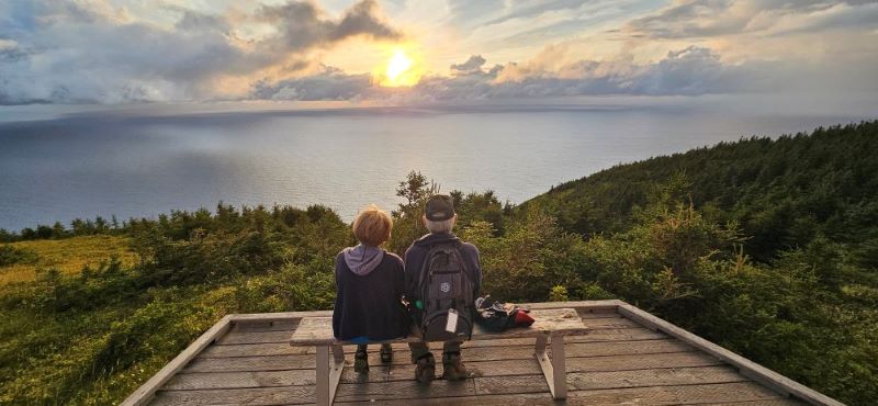
Our view when we got up this morning
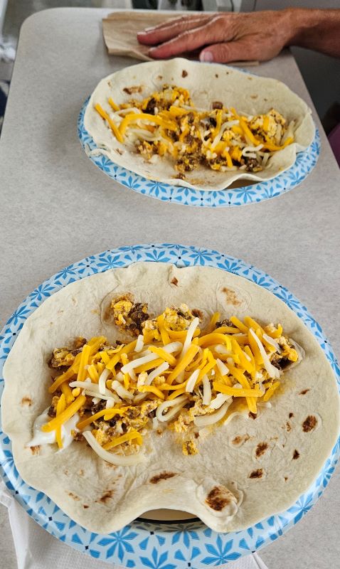
Since we were in no hurry this morning we took time to fix chorizo, egg and cheese burritos for breakfast
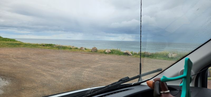
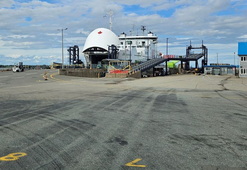
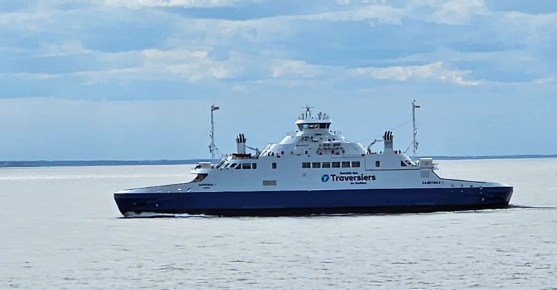
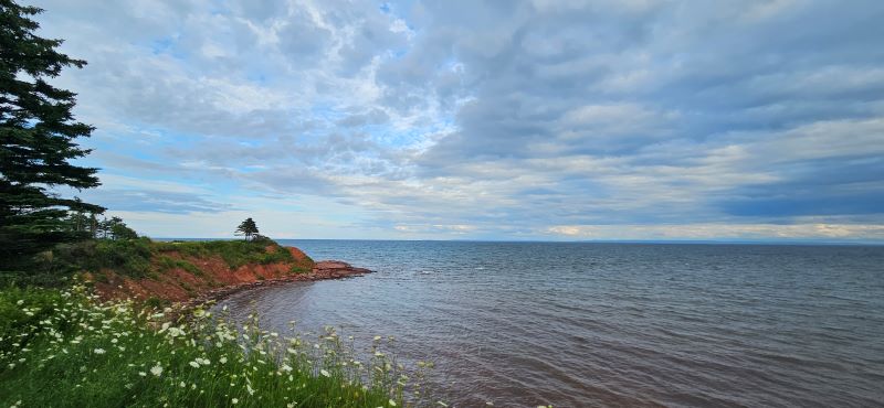
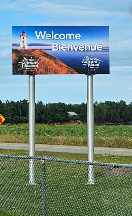
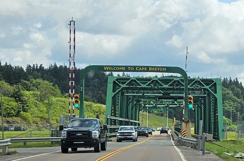
This morning it was time to head south, off of Cape Breton Island. We had planned today as a repositioning and preparation day but things changed a bit as we drove along. There was a lot of construction delays as we drove from Cape Breton, to the Canso Causeway. We crossed over the big green bridge back into Nova Scotia, and continued on to Caribou, NS which is where we had planned to ready ourselves for tomorrow’s ferry trip to PEI. We went to a small Provencial Park, emptied our tanks and took on fresh water but then we Gumby-ied everything. We decided to visit the ferry terminal to make sure we knew exactly what would happen tomorrow. We had spoken with people with the ferry call center/reservations twice and were given totally different answers to our questions with different costs for the crossing. Turns out all we had to do was pull up to the ferry booth and talk to a kind gentleman who said we could go on the next ferry that would depart in about 50 minutes and the cost would be $0.00. That sounded like a much better plan than the $134.00 the man on the phone told us. We were driving aboard the ferry about 15 minutes after we pulled up to the booth to ask our questions. It takes about 75 minutes to make the crossing. It was a beautiful afternoon to be crossing to PEI. (Tomorrow is predicted to be windy, and rainy all day.) The PEI/NS ferry is free going to PEI but you have to pay to return to Nova Scotia. (not $134 but about $100.00) We aren’t planning to return to NS on this trip. We plan to drive from PEI, over the Confederation bridge to New Brunswick. It is a toll bridge so we will pay the $50.65 toll for BB to cross the bridge. All is well and tonight for our first night on PEI we are parked right beside the Atlantic Ocean watch the waves hit the shore and a cruise ship go by. There are supposed to be some seals here as well but we haven’t seen them yet. It was a very good day!
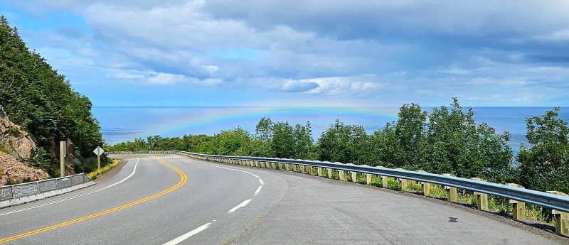
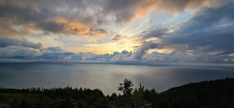
Our last day on the Cabot Trail and we get another rainbow.
We waited only a few minutes to board the ferry.
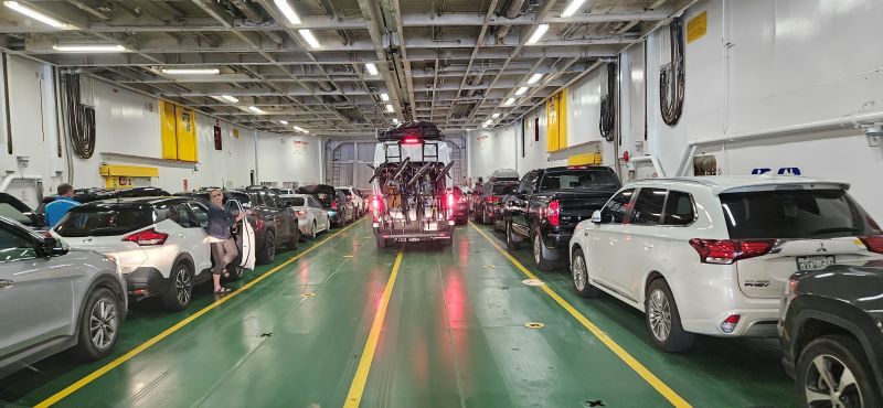
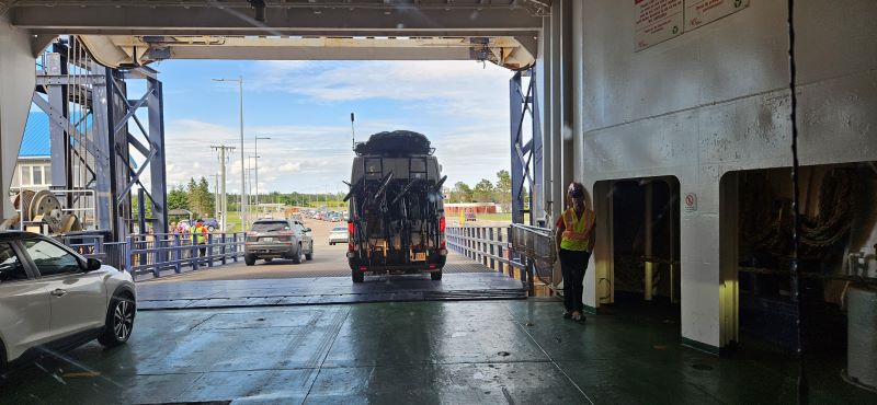
Following another van on to the ferry
BB’s first big ferry ride
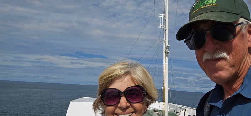
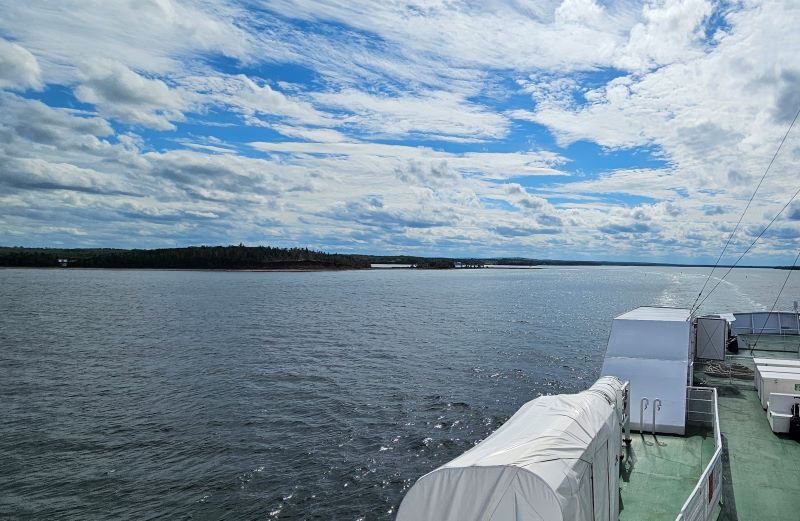
On the way to PEI
Goodbye, Nova Scotia
The other ferry going from PEI to NS
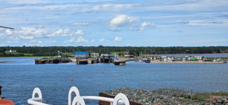
Approaching the PEI Ferry Terminal
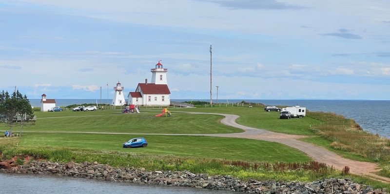
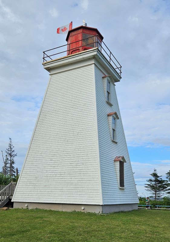
Woods Island LIghthouse is beside the ferry terminal
Woke up to off and on rain this morning. We are watching the weather a little more closely since a friend sent us information from Meteologix Canada indicating there is a possibility of a hurricane affecting the Canadian Maritimes around August 15. This information was a surprise to us, but you know we will now watch things closely. If need be, will cut our trip short or find a place to hunker down if needed. It is still very early but we do appreciate the heads up.
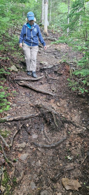
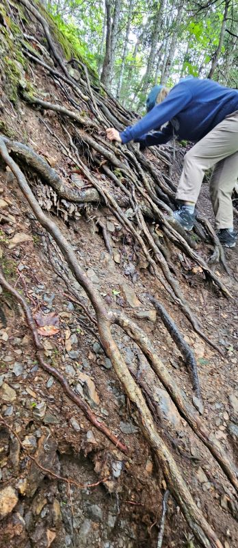
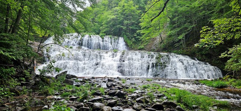
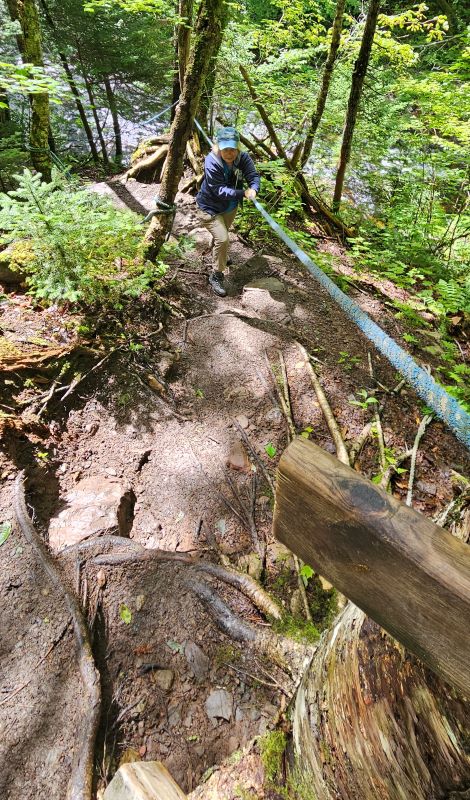
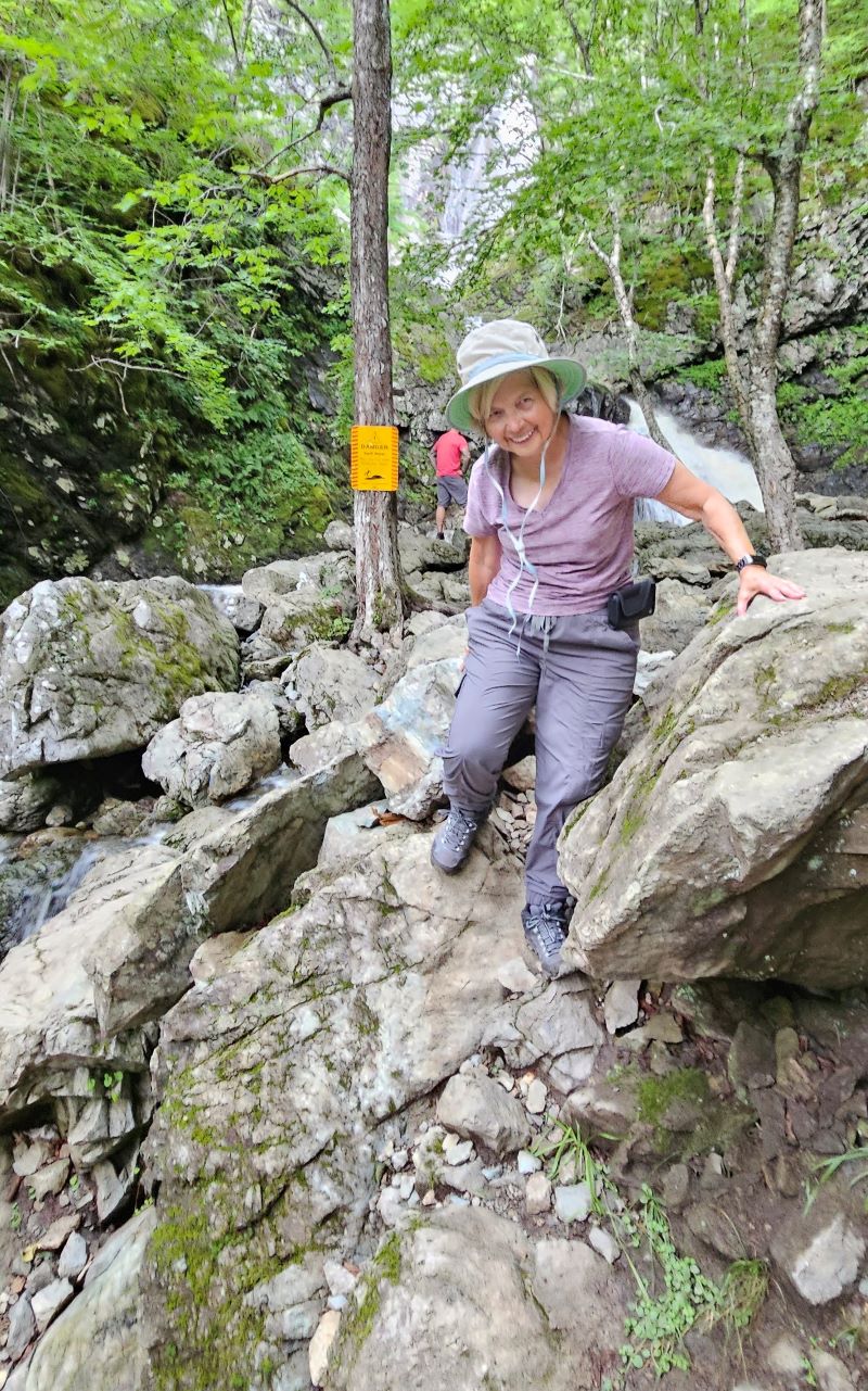
This morning after another “see you down the road” to Lynn, Owen and Maggie we went on another hike we had skipped when here last, Egypt Falls. It’s not a very long hike and is listed a moderate on All Trails but it’s a pretty tough hike. It’s just pretty much all down hill from the start and therefore all uphill on the return. There are several places where there are ropes to use to keep you from sliding down the hill or help you get back up. We needed the ropes a few times. It was also a little muddy and slippery today. However, the payoff was tremendous. This is now our favorite water fall in Cape Breton, and probably of this trip.
The road to the Egypt Falls trailhead
The trail down to the falls started like this …
… and then it became this.
Egypt Falls
Our new favorite
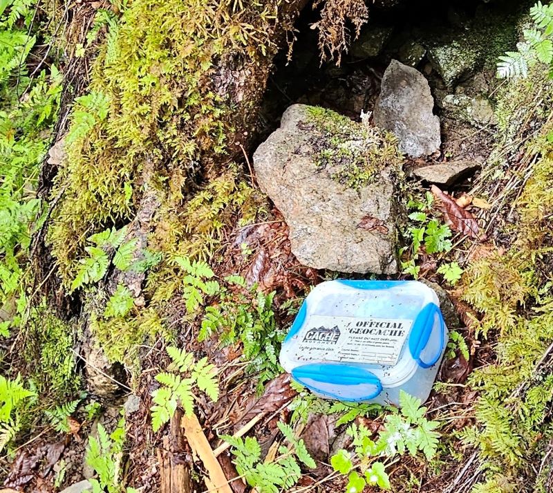
While we were at the falls we checked our geocaching app and found out there was a geocache only a few feet from where we were standing.
The trail back up at least had ropes to hold on to.
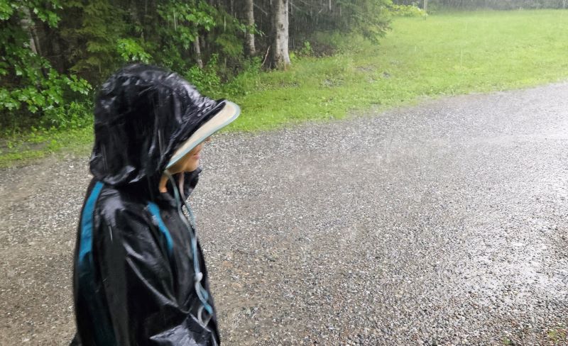
After completing the hike we headed to a laundromat to dry our clothes that were drenched yesterday. We hung them in the shower last night with a fan but…still wet this morning. They were dry in 20 minutes at the laundry mat and then we went back into the National Park. We went back to the Skyline Trail because another thing on our to-do list is to hike to the point at sunset. We left the parking lot at about 7:00 to hike out to the point on the Skyline trail. Sunset was not until 8:26 but it’s about 1.7 miles out to the point and we didn’t know how crowded it would be. There were people there waiting for sunset but not really as many as we expected. It was windy and the closer to sunset it got, the colder it got. Unfortunately, it also started misting rain. Never really rained hard, but we were glad for our raincoats and they were quite damp by the time we got back to BB. It was not a magnificent sunset but it was a good one. We like our pictures and are glad we made the effort. So now after a short drive, we are at another Ioverlander spot in Pleasant Bay. There are several other vans here and we can listen to the surf beating against the shore all night. It was another great day.
Watching and waiting for the sunset
The sky was beautiful just a few minutes before sunset. Rain and clouds obscured it right at sunset.
We had a quiet night in the Truro WalMart parking lot last night. There were at least 13 other RVs in the parking lot when we woke up this morning. First, we headed back toward the Fundy Discovery Center that we tried to visit yesterday but wouldn’t drive through the water to get there. Today there was no water over the road in the area we could see but the road was now barricaded and there certainly could have still be water further on down the road.
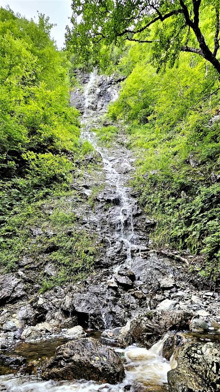
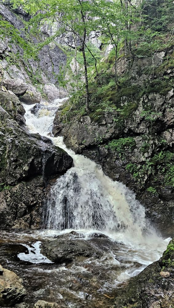
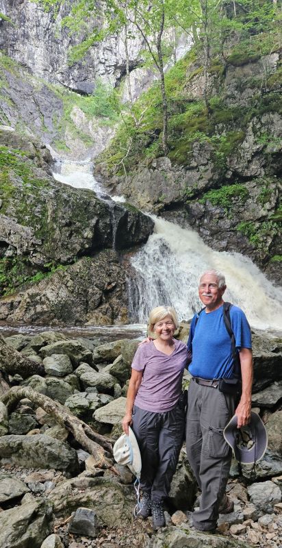
We decided to drive on to Cape Breton. It was so hot when we were here two weeks ago that we skipped some hikes we had on our to do list. Today we decided to hike to Uisge Ban Falls (pronounced OOSH-KA-ban, ISH-KA-ban, or Eeesh-kah-ban) and is Gaelic for “white water”. Cape Breton has very strong Irish and Scottish roots. The hike is rated moderate on All Trails and that is probably about right. Currently the road into the Provincial Park is closed due to a washed out bridge so we had to walk down the road and over the closed bridge to get to the trail head. The first portion of the actual trail is easy with a nice gravel path to follow. Closer to the falls there are rocks and boulders to climb over or around to get a good view of the falls. You then arrive at a tall waterfall in a beautiful granite gorge that today had a lot of water flowing over it. It was a great hike with a really good payoff for the effort. Our total hike was 2.8 miles. However, about 2/3s of the way back to BB, it began to rain – really rain. We were drenched. Sure glad we had BB with all our clothes.
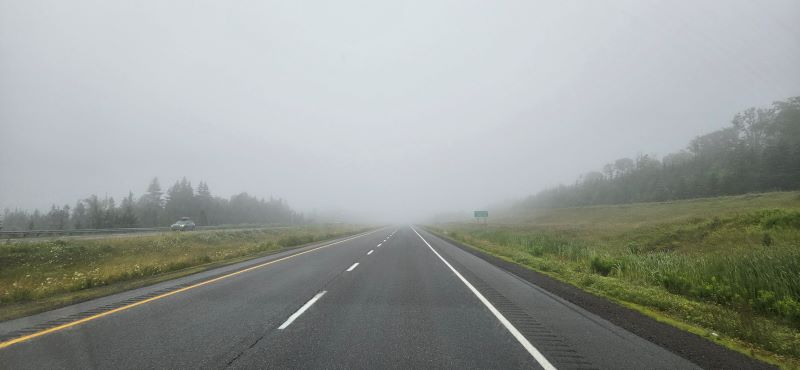
It was another foggy morning drive.
Back to Cape Breton
This washed out road to the park is why you can’t drive to the parking area.
on the way to the falls there are two high thin falls.
It takes a little scrambling over rocks to get to the falls.
It’s hard to see all of Uisage Ban Falls because of the trees, but they are much higher than they appear in this picture.
The payoff was well worth the hike …
… even worth the soaking we got on the way back.
After changing into dry clothes we drove about 25 minutes to our Harvest Host site for the night. It’s a brewery but they also have smash burgers and pizza. Unfortunately, they were sold out of pizza and the food truck for the smash burgers was closed for the one night of the season. Oh well, we had plenty of food in the freezer. While we were eating supper, to our surprise our friends Owen and Lynn pulled into the parking lot. We knew they were in Cape Breton but didn’t know where. We had another good evening of visiting with them. So much fun to meet up with friends on the road. Hope you have all had a great weekend.
We will begin the day with a correction. On more than one occasion we have referred to Nova Scotia as an island. A friend reminded us that it is not. We knew that, but it just feels so much like an island. Nova Scotia has a 7,500 km (4,660 mile) coastline but is connected to New Brunswick across the only 25 km (15.5 miles) wide Chignecto Isthmus. As you recall we drove to NS from New Brunswick. So, even though it is not an island, the vast majority of NS is surrounded by water and it definitely feels like an island when you are sitting on the beach just chilling. More importantly, it is just an absolutely beautiful place that we are so glad we have visited.
Now on with what we did today. We were on the road at 6:40 headed to the bakery to pick up sticky buns. You will recall that we loved the sticky buns we got from the Wolfville market last Saturday. Max did a little research and determined the location of the bakery to be less than five minutes from Lunenburg, in Blockhouse, NS. It’s a delightful French bakery, can’t pronounce the name but it’s Boulangerie La Vendeenne. We visited the bakery yesterday but they were out of sticky buns. They had made 100. They said they would make more for today but that we needed to come early. They open at 7:00 so we were there before 7:00. Oh, those buns are sooo very fine.
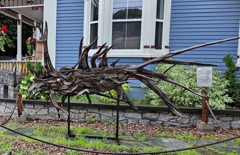
As we were leaving Mahone Bay we saw these two driftwood sculptures.
We’re really not sure what they represent.
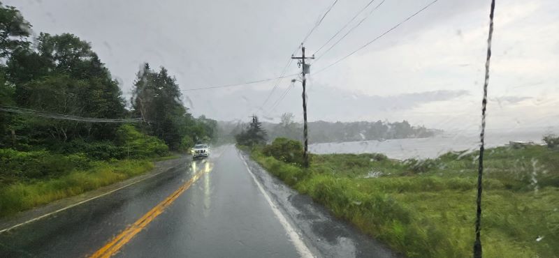
Much of our drive today
Our next stop was unexpected and sad. On our way to Peggy’s Cove we saw a sign for the Swissair 111 crash sight. We remembered a little about this commercial airline crash but had to look up the specifics. It occurred Sept 2, 1998 on a flight from JFK to Geneva, Switzerland. The plan went down in the Atlantic Ocean not far from Peggy’s Cove, due to electrical and instrument failure due to an inflight fire causing spatial disorientation and loss of control of the plane. 227 lives were lost. We stopped and walked up a little hill to the memorial.
Swissair 111 Memorial
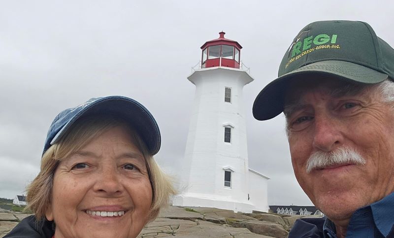
Our first view of Peggy’s Cove Lighthouse was from the Swissair 111 memorial.
Next stop Peggy’s Cove. This is one of the places everyone told us we had to see. It’s actually a very small village, population of 30 permanent residents. They say they have everything to support daily life – a schoolhouse, church, general store, lobster cannery, and boats of all sizes. They also have an iconic lighthouse that is pictured in post cards and tourist brochures for NS. There were way more than 30 tourists taking pictures this morning even with the off and on rain.
You can walk out to this lighthouse, but you cannot go inside.
It is out on this solid rock point, which is good because there are signs all around warning of the risk unexpected large waves washing tourists out to sea.
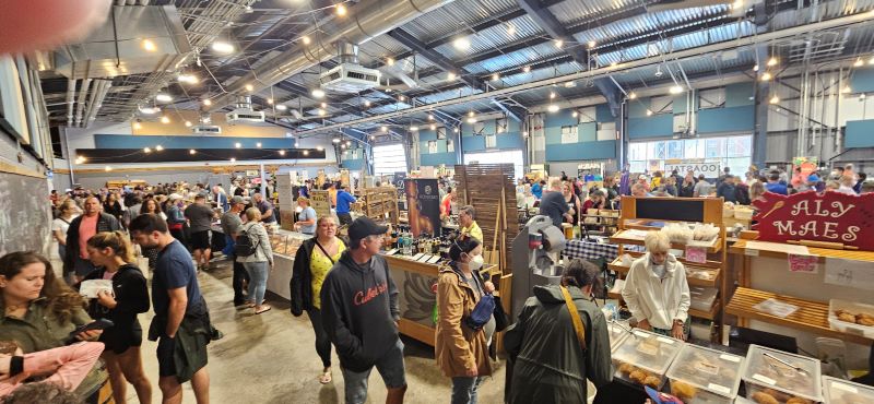
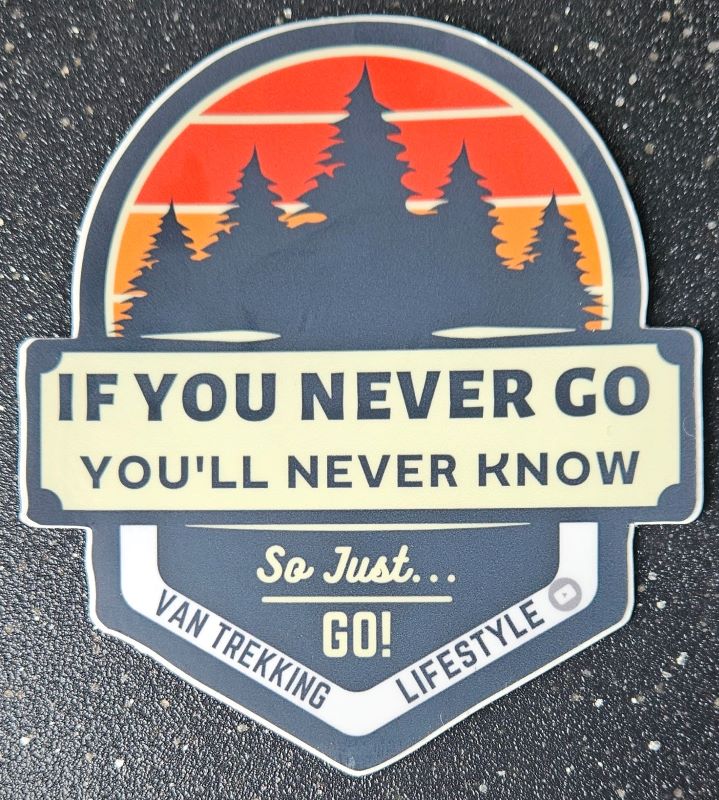
After walking on the rocks and taking pictures, we were off to Halifax, the provincial capital. Due to the flooding of two weeks ago, we had to make a couple of detours but soon we were in the traffic of Halifax. So thankful we were here on Saturday because we know traffic would be much worse during the work week. We wanted to go to the Halifax Seaport Farmer’s Market. It is the oldest continuously operating farmers’ market in North America having been founded in 1750. It was very crowded. To be truthful, we were a little disappointed. We expected it to be larger and with more diversity of vendors. The market in Wolfville has been our favorite so far. We remembered what a wise man once told us “If you never go, you’ll never know.” So we go.
Halifax Seaport Farmer’s Market is not very easy to drive to.
We didn’t stay very long.
If you never go, you’ll never know
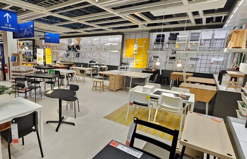
One of the things we could do in the rain is visit our first Ikea.
Anyone need a chair?
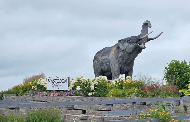
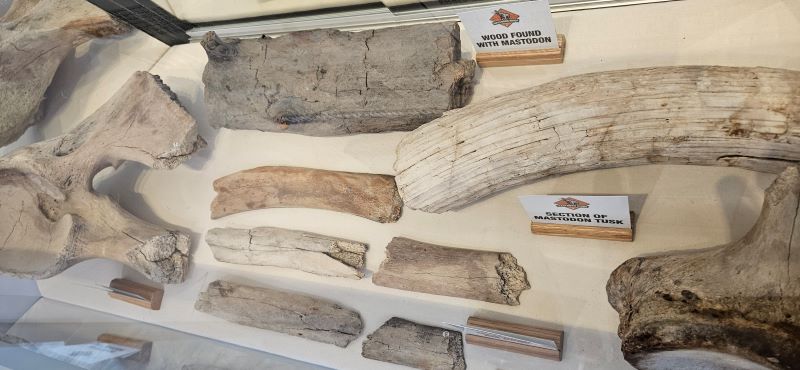
After leaving Halifax, on our way to Truro, we stopped at the Stewiacke Tourist Information Center. We had been told that they would allow us to fill our freshwater tank. This was another interesting stop. We got a lot more than water. The owner greeted us and immediately gave us permission to fill with water. We asked him about the “Mastodon Ridge” name. He told us the story of the finding of mastodon bones in a gypsum quarry nearby. He took us inside to see some of the mastodon bones on loan from the Halifax museum.
The little park at Mastodon Ridge was closed today because of water damage.
The mastodon bones at the tourist information center.
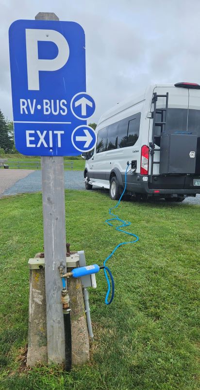
We always appreciate free water fills and free dump stations.
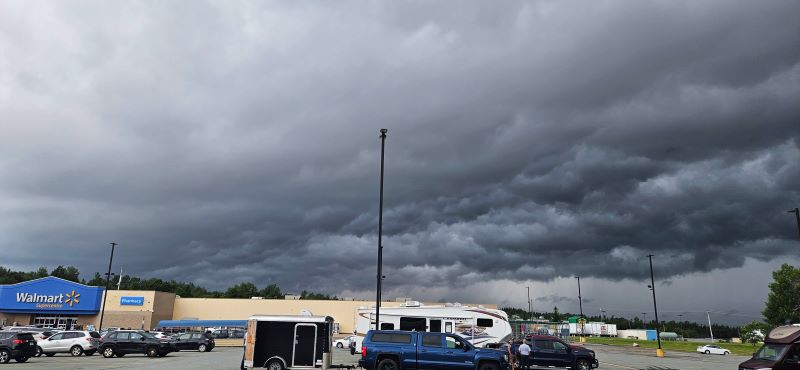
It was a very interesting day but we stopped early to avoid more storms and flooding. Be sure to be praying for your pastors as they prepare for the Sunday messages – that they will speak what God wants them to speak and we all will have ears to hear.
So this is where we ended up waiting out another storm.
This is how we end every day. Just a little earlier today because the road to one of the places we planned to visit was flooded. We remembered the adage “Turn around, don’t drown” and turned around.