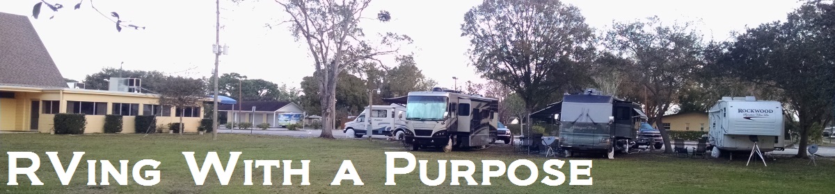
It rained all night. The storms were predicted to be out of our area by morning. NOT. Some of the strongest winds and rain occurred around 8:00am. We decided to just stay where we are for the day. We are comfortable, safe, dry and have plenty of food. We haven’t heard of any current road closures around us but we also don’t get any local TV channels so…it’s a little more difficult. We decided to just have a quiet day, let some of the water recede and Anne caught up our map for states where we have spent at least one night in the RV and caught up on some business items. It’s been a restful day.
Coloring in the last US state we RVed in. We don’t have a Canada map but we have RVed in 5 of the 10 provinces and 1 of the 3 territories.
Do you know the difference between a Canadian Kit Kat bar and a US Kit Kat bar?
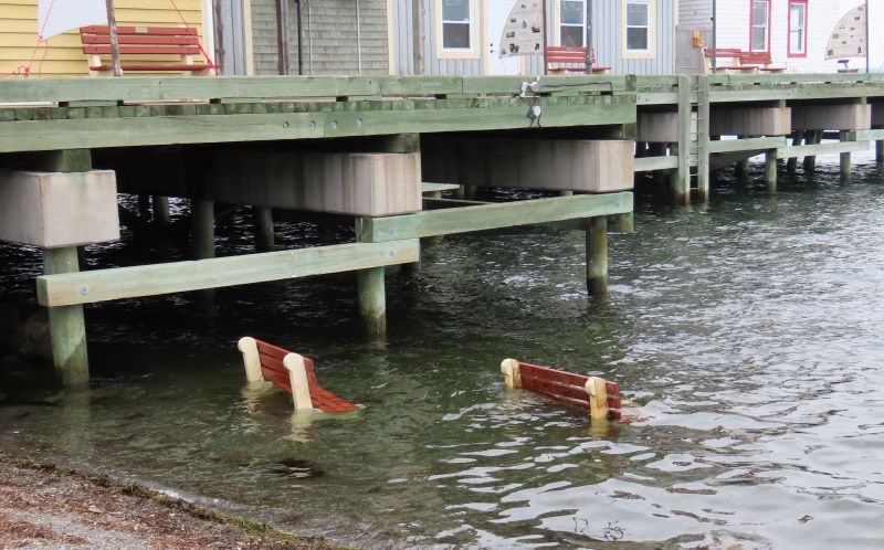
It did not rain overnight as was predicted. We even stowed our Starlink after posting the blog last night because we didn’t want to have to do that in the rain this morning but it wasn’t raining when we got up. It wasn’t raining when we left our Boondocker’s Welcome site either. Those are the only two times it hasn’t rained in the past 36 hours. Checking the news tonight we found there are reports of flooding in a number of areas of Nova Scotia. Also, a report of four missing persons after cars were swept away. Over 150 homes reported damaged due to high water in Halifax. Please be praying for the people of Nova Scotia. They have already endured horrible wildfires this summer and now this.
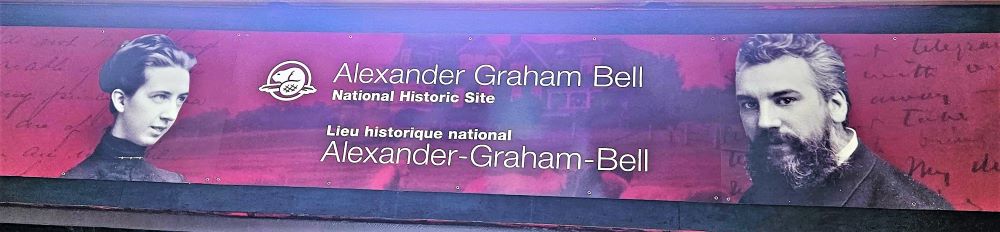
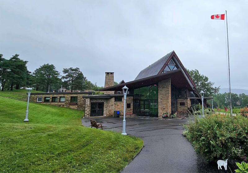
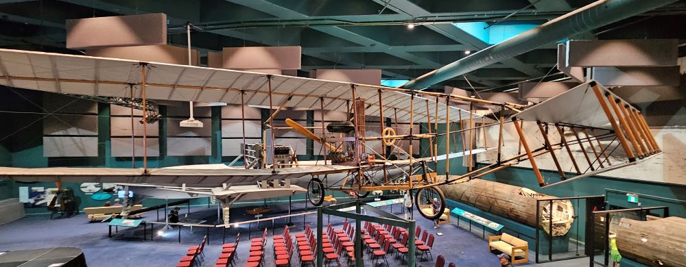
We decided last night, based on the forecast, that we would drive to the Alexander Graham Bell National Historic Site in Baddeck, Nova Scotia on Cape Breton Island. A good rainy-day activity. All of you probably immediately think of the invention of the telephone when you think of A.G. Bell and you would be correct. He also was a pioneer in the field of deaf education. This was a real passion for him. He worked on flight much like the Wright Brothers and they even worked together on some things. Bell also did a lot of work with kites and transferred what was learned, to the airplane. He also worked with hydrofoils. It was a very interesting morning and we learned a lot.
Why we had an inside day. Much of our drive today was in much heavier rain with water on the road.
Alexander Graham Bell National Historical Site
What most people think of when they think of Alexander Graham Bell
There is also one of these old switchboards on display in AT&T building in Birmingham.
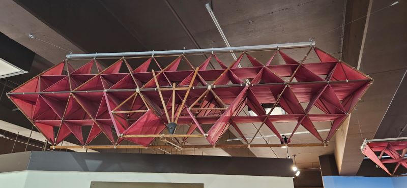
One of Bell’s kite designs that use used for testing manned flight.
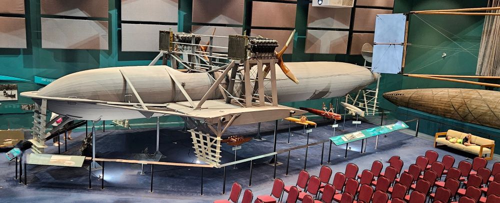
This full-size replica of one of Bell’s airplanes is hard to photograph because it takes up some much of the room.
Full-size replica of one of Bell’s hydrofoil boats
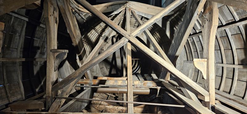
The original hydrofoil hull was abandoned on a beach and later recovered. It is now in the museum. This is Inside the original hydrofoil hull.
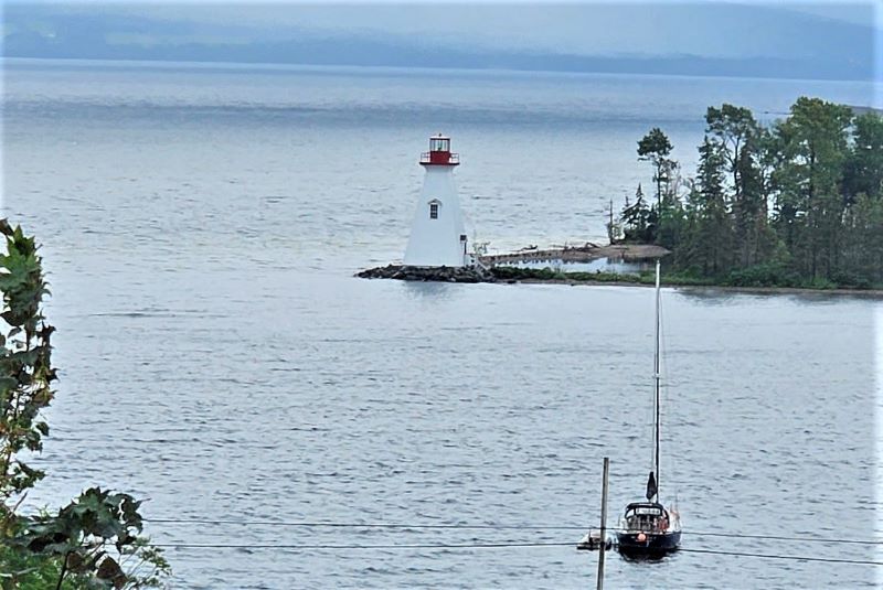
You can see the Kidston Lighthouse from the museum but it is on an island.
After spending about 3 hours in the museum, we headed back to BB. It had stopped raining and we thought we might do some additional driving on the island. Before we could walk to the RV parking lot, there was another deluge. We were dripping water all over the floor when we got back in BB. Oh well, at least we had dry clothes to change into. While driving back to our Boondockers Welcome site from last night we started seeing areas of water almost over the road and lots of water on the road. We decided we would be better off to seek some high ground and just get off the road. We contacted our hosts and told them we were not returning and they replied “I don’t blame you, just stay safe.” We were never in any danger but just decided we didn’t like the driving conditions. It’s one of the benefits of traveling the way we do. We pulled off the road, prepared supper and we will be spending the night tonight in a parking lot, high and dry. We will be checking on roads before we decide which direction to travel tomorrow. Even though it was a really wet day, it was still a good day. Don’t forget to pray for the people of Nova Scotia and your pastor’s as they prepare for the services tomorrow.
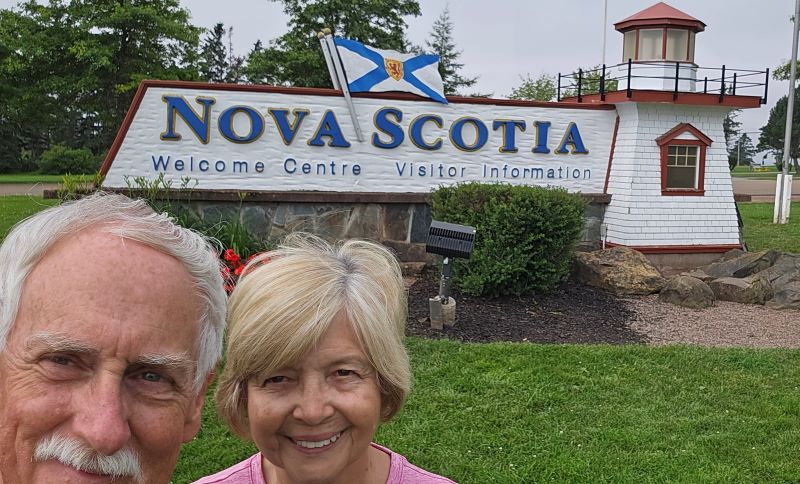
We had a great night of sleep last night at a Boondockers Welcome site in Moncton, New Brunswick. Our hosts were out late last night and we didn’t meet them until this morning when we had a nice visit before getting back on the road. Today we left New Brunswick and crossed into Nova Scotia. We have been trying to get to NS for 3 or 4 years now. Finally made it today. We stopped at the Welcome Center and were immediately impressed. The landscaping was beautiful, the rest rooms immaculate, and the people responsible for giving you information were very helpful. We told them where we were headed and they offered some suggestions for a better route that would be more scenic. We took their advice and have absolutely no regrets about the detour. The route did take longer but that was because we kept stopping and looking at things and taking pictures.
Nova Scotia Welcome Center
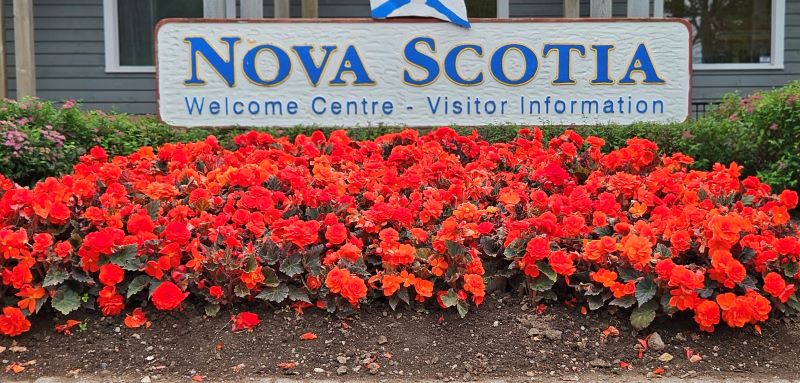
Flowers at the Nova Scotia Welcome Center
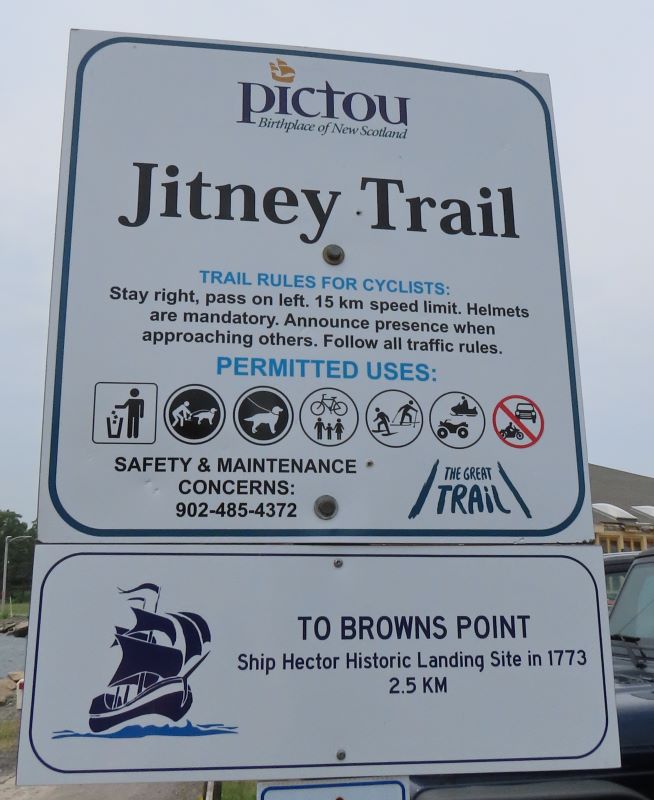
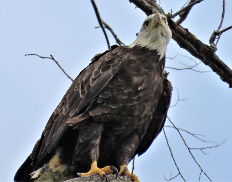
We entered Nova Scotia at Amherst and then instead of taking the Trans-Canadian highway, we detoured to The Sunrise Trail and followed that scenic route along the northern shoreline. The first portion of the drive was through more agricultural area. We were very appreciative of the farmers who placed signs beside the road indicating what was growing in the fields. We would not have guessed the rhubarb fields. We really enjoyed driving through the countryside. We looked at the map and detoured into the town of Pictou because it looked like an interesting little town and we were ready to stretch our legs. We were glad we had a driving day today after the past two exercise intense days but we still needed to do some walking. We found a really nice walking trail along the shore an while walking spotted two eagles, one full grown, maybe the mom and a juvenile not yet displaying his white plumage. We also saw a number of painted rocks around town. We have a friend who paints rocks that would have really enjoyed this town.
Getting some exercise on the Jitney Trail was one of the reasons we stopped in Pictou
Juvenile bald eagle
Adult bald eagle
Painted rock garden in Pictou
In Pictou we watched these men sawing lumber …
… to build this replica sailing ship for the town.
Pictou even provides low tide seating
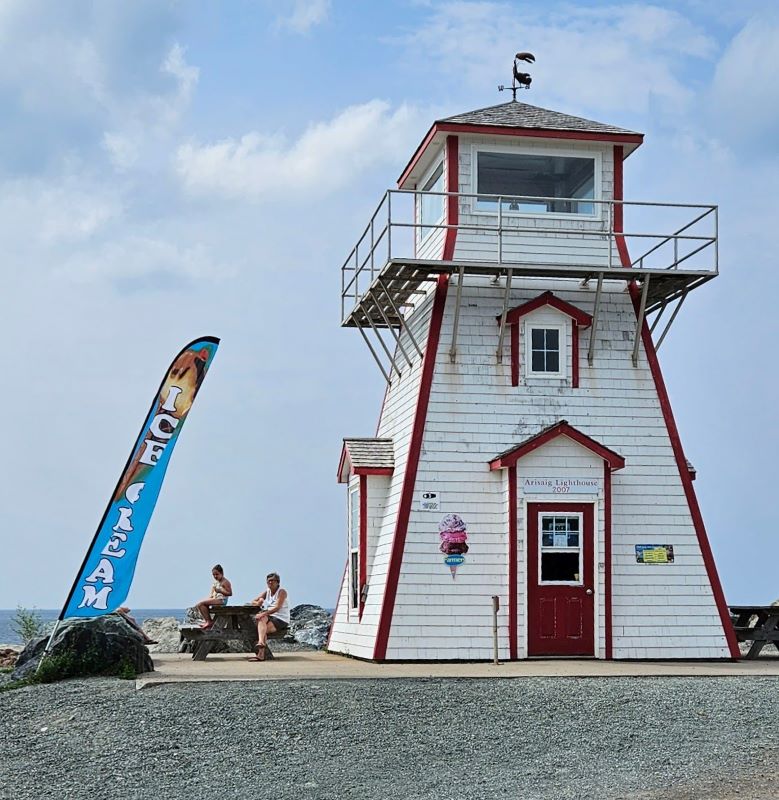
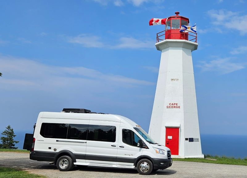
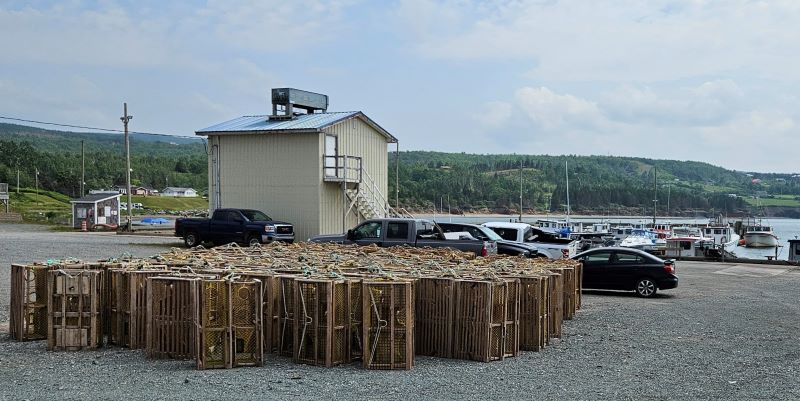
Next detour was at Arisaig to photograph a light house. It was no longer active and actually had an ice cream shop inside. We couldn’t buy any ice cream because we already had ice cream in Pictou. Arisaig seemed to be a lobstering town. Lots of lobster traps in the yard and a lobster processing house as well. Heading on further east our next detour was at Cape George to photograph that lighthouse. It really is a light house that is situated on a cliff above the St Georges Bay. What a great view of the bay!
Ice cream lighthouse
Cape George Lighthouse. Sometimes you can see Prince Edward Island from here, but not today.
By detouring to the Sunrise Trail we were able to see lots of dairy and farm land …
… many beautiful seaside views …
… several scenic towns …
… lobster fishing ports …
… and many more picturesque churches.
From there we headed toward another Boondockers Welcome site for the next two nights not far from Port Hawkesbury. Our host couple has recently moved to Nova Scotia and are so happy here. They seem so pleased to share their beautiful place on a lake. We understand they frequently have loons visit them and we are hopeful we will get to see and hear them while we are here. Thank you, God, for a beautiful and safe travel day. Enjoy your weekend!
Our home for our first night in Nova Scotia.
Our hosts like signs and we will be sure to abide by this one.
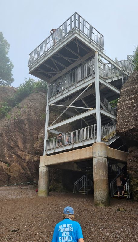
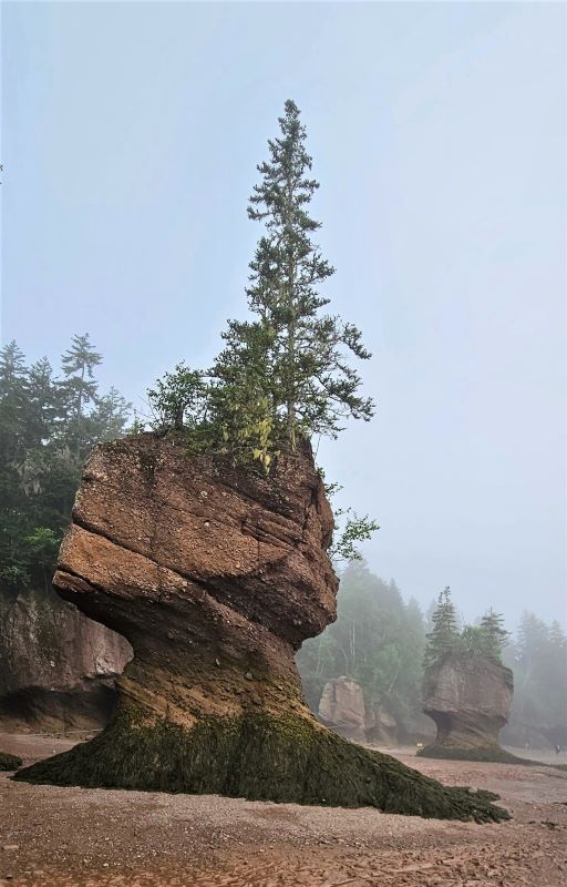
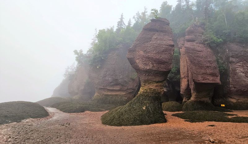
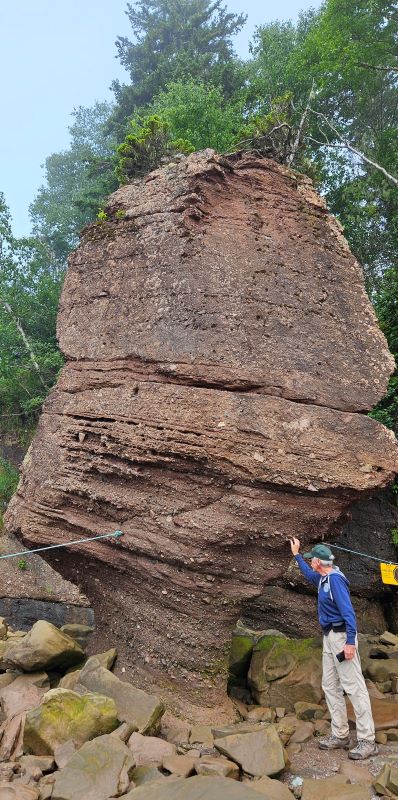
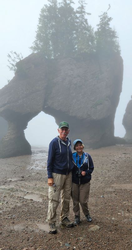
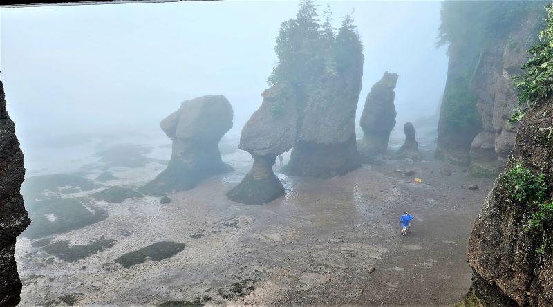
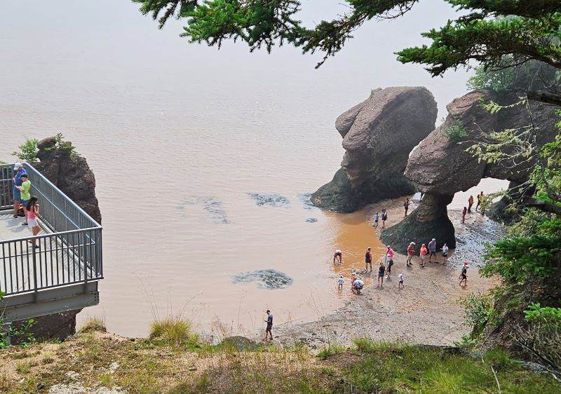
This morning we were up early and headed to Hopewell Rocks, about 45 minutes from Fundy National Park. Hopewell Rocks is a New Brunswick provincial park and is located on the Bay of Fundy. Hopewell Rocks, also called Flowerpots Rocks or The Rocks, are rock formations known as sea stacks, caused by tidal erosion by the massive tides of the Bay of Fundy. The formations are 40-70 feet tall. There are over 23 sea stacks standing along the shoreline of the park. The park is considered a “self-guided tour” but there are interpretive staff on the trails, the landings of the stairways to and from the ocean floor, and out among the sea stacks. They are very knowledgeable and are anxious to answer questions and share their love of the park. The stairs down to the ocean floor are 100 steps, one way. We made 3 trips up and down those steps today. We both got credit for 76 flights of steps on our fitness tracker and over 20,000 steps. That’s two days in a row of some serious exercise. It may be an Ibuprofen night tonight.
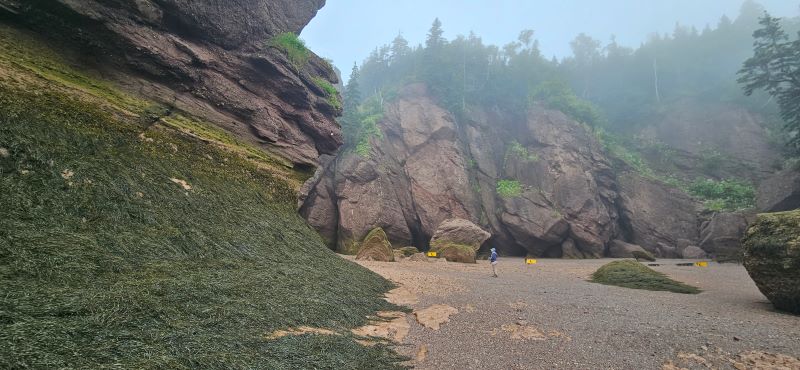
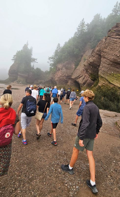
We arrived at the park at about 7:40 and that put us second in line for entry into the park at 8:00. We were on the ocean floor about 8:15 walking among all the various rock formations. Very impressive. You must be careful because some areas are extremely muddy. We are so very glad we arrived early. We had about 6 other people exploring the rocks with us. After exploring all the way to Diamond Rock and back to the main stairs, there were probably 300 people on the ocean floor including a large tour bus group. After our morning exploration we went back to BB to have a late breakfast. Low tide was at 9:05 am and then the tide started back in. We went back to the floor about 2.5 hours later to see how much progress the tide had made. We were surprised at how fast the water was coming back in. There were already some places formations had water at the base. We could stand at the water’s edge and in one minute our foot would be covered by water. Back to BB for some rest and then we again went to the stairs to the floor at 2:30, high tide. Amazing! The last section of the steps to the floor was closed due to high water and water was near the base of the cliffs.
The sidewalk to the park entrance is actually flat, but it sure does not look like it.
The steps down to the beach
One of the most picturesque flower pots
More flower pots
This flower pot looks like it could fall over at any time.
The rock formations are much bigger than they look in pictures
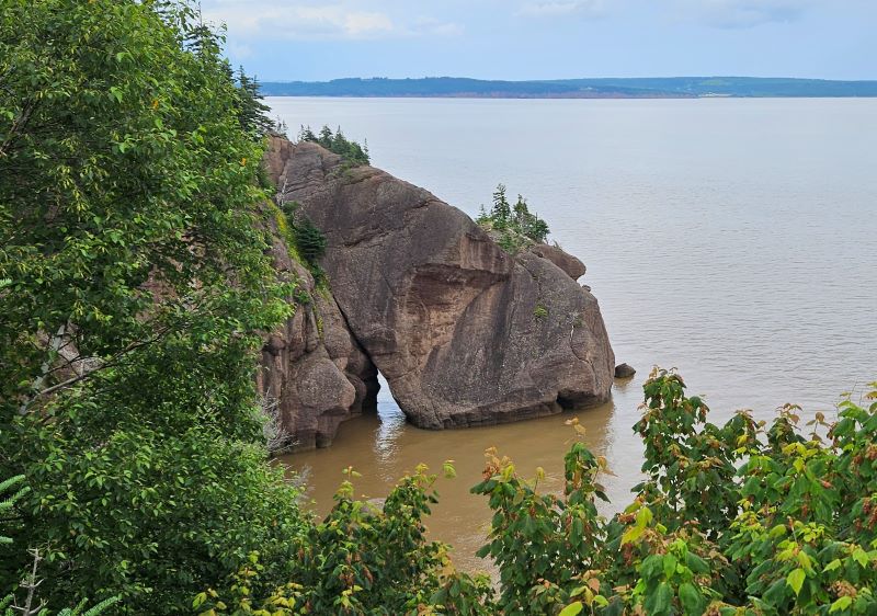
This formation is known as Lovers Arch.
Somewhere out there is Nova Scotia – where we are going tomorrow.
We are glad we got to the beach early. This is how the beach looked by 9:15.
You have to step carefully when walking on the ocean floor.
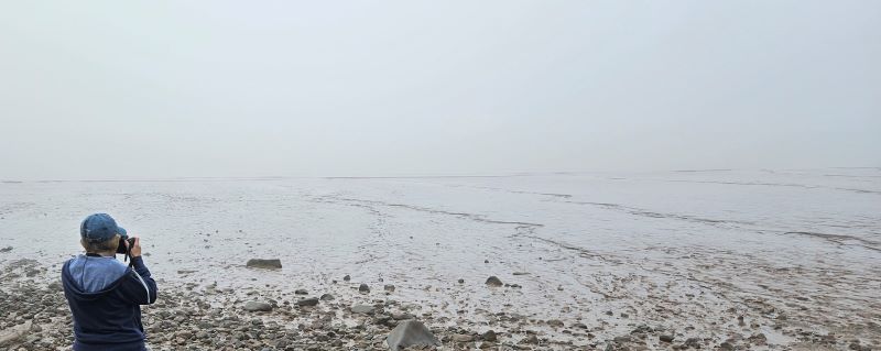
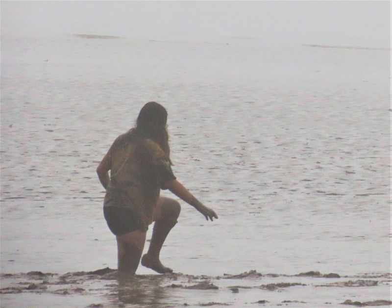
There are signs advising visitors to stay out of the mud flats, but this touron was over 100 yards out before a ranger could get her to come back in
As the tide came in and cut off areas of the beach the rangers herded the tourists back toward the steps.
The beach at low tide
The beach with the tide coming in
The beach at high tide
Water around the base of the steps
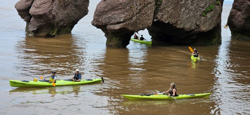
Kayaks where we walked this morning
Diamond Rock at low tide. It was so foggy when we arrived you could barely see the top of it from the viewing platform,
We had just walked under Diamond Rock.
Diamond Rock with the tide coming in
Diamond Rock at high tide
After our last trip the water at high tide, we said goodbye to our new interpretive friends and climbed in BB and headed to Moncton, New Brunswick. It sure was nice to have BB in the parking lot today to visit for rest from all the walking and step climbing. It was another very good day.
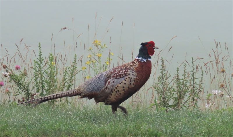
Pretty pheasant we saw leaving the campground
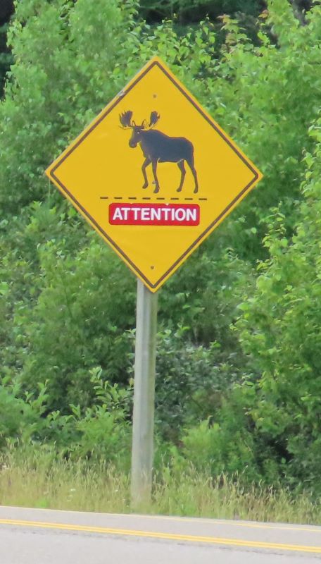
Still the only signs of moose we have seen here
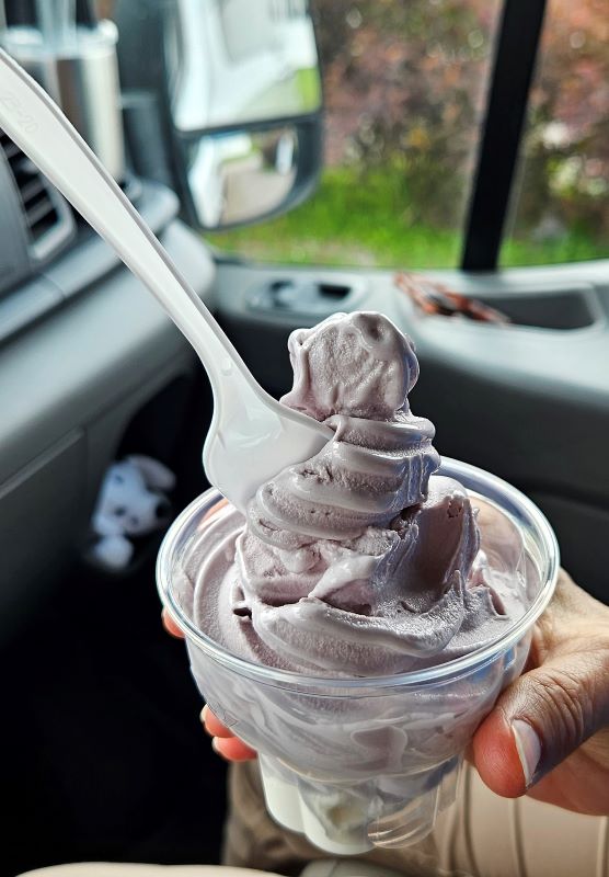
We did make one stop between Hopewell Rocks and Moncton. (It’s blueberry soft serve.)